Nauru covers 21 km². Central Park covers about 3.4 km², so the island wins that comparison, but only just, and only because Central Park is a park. On a globe, Nauru registers as nothing. A speck in an ocean that covers a third of the planet's surface.
So how does a country that small insist it exists?
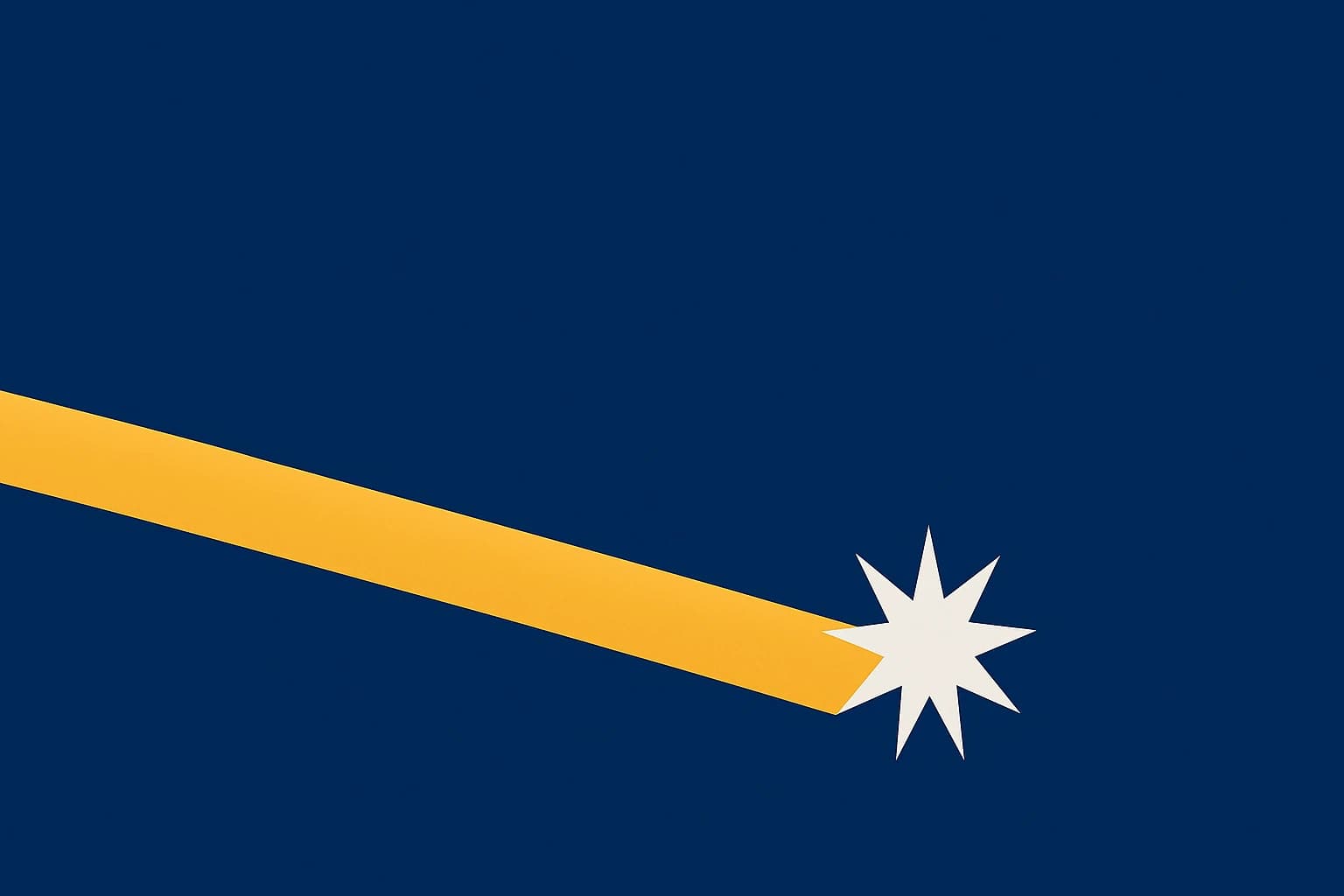
Nauru's flag answers that question in an unusual way. It is less a symbol than a coordinate. A deep blue field, a horizontal gold stripe, a twelve-pointed white star sitting below the stripe. Three elements, and between them they tell you exactly where this nation sits.
The problem of being nowhere
Nauru's population hovers around 10,000. It is a single raised coral island alone in the central Pacific, the world's smallest island nation-state and the third-smallest country overall, after Vatican City and Monaco. It has no capital city in the traditional sense, no rivers, and no harbors deep enough for large ships.
The isolation is hard to overstate. Nauru sits roughly 4,000 km from Australia. Its nearest neighbor, Banaba (Ocean Island), lies about 300 km away. On most world maps Nauru doesn't appear at all, because it's too small for the scale.
That creates a design problem most countries never face. When your country is functionally invisible on a map, what does national identity look like? How do you say "we are here" when cartography itself erases you?
Nauru spent decades under foreign control. Germany administered the island from 1888. After World War I, Australia took over under a League of Nations mandate and later a UN trusteeship. When independence came on 31 January 1968, the question of self-expression became both urgent and newly possible. The flag was adopted that same day.
And the flag does not describe what Nauru looks like. It describes where Nauru is.
Reading the flag like a map
The deep blue field represents the Pacific Ocean. Not metaphorically. The Pacific is blue, and the flag is blue, and the blue runs edge to edge because the ocean runs in every direction from Nauru without interruption for thousands of kilometers.
The horizontal gold stripe across the middle represents the equator. That is a strange thing to put on a flag. The equator is an invisible line that exists only by agreement, and Nauru drew it on the national banner.
Then there is the star: white, twelve-pointed, sitting below the gold stripe in the lower-left portion of the flag. That placement mirrors Nauru's position, one degree south of the equator, in the east-central Pacific. The star is not decoration. It's a pin on a map.
The twelve points carry a second meaning. Each one stands for one of Nauru's twelve traditional tribes, so a single shape holds both geographic precision and ethnic identity.
The design came out of a national competition in the lead-up to independence. Citizens submitted proposals, and the winner became the flag on 31 January 1968, which makes 2026 its 58th anniversary year. The result works as symbol, map, and declaration at once. Most flags never attempt even two of those.
Why geographic self-mapping almost never happens
Most national flags communicate identity through color symbolism, historical emblems, religious imagery, or solidarity with a broader movement. Pan-African greens, yellows and reds. The Arab Liberation colors. Crosses, crescents, and stars carrying political rather than geographic meaning. Those flags say what a nation believes, or who it fought alongside. They don't say where a nation sits.
Geographic self-mapping is rare because it needs a particular condition: a nation defined primarily by where it is rather than what it believes or who it opposed. That tends to describe small, isolated, oceanic states, places where location is identity.
The contrasts are easy to find. The Union Jack encodes political union, layering the crosses of England, Scotland and Ireland.
South Africa's flag, redesigned in 1994, encodes reconciliation and the convergence of different peoples into one path forward.
Brazil's flag encodes positivist philosophy and the night sky over Rio de Janeiro on 15 November 1889. Its stars represent actual constellations, but they mark a moment in time, not a location on a map.
There are partial exceptions. Cyprus's flag, adopted in 1960, includes a copper-colored silhouette of the island itself.
Kosovo's flag, adopted in 2008, shows the geographic outline of the territory below six white stars.
Both of those are literal maps, though: traced outlines. Nauru's approach is abstract. It uses geometric relationships, a stripe and a star and their positions relative to each other, to encode coordinates. It doesn't show you what the island looks like. It tells you where to look.
The Marshall Islands did something similar
If Nauru's flag is the purest case of geographic self-mapping, the Marshall Islands flag is its closest sibling.
Adopted in 1979, it has two diagonal stripes, orange and white, rising from the lower-left to the upper-right corner, with a large white star in the upper-left canton. The orange stripe stands for the Ratak chain, the "sunrise" islands. The white stripe stands for the Ralik chain, the "sunset" islands. Those are the two parallel island chains that make up the country, and on the flag they run as they run in reality, northwest to southeast. The flag is a diagram of the archipelago.
The star has 24 points, one for each municipality, which echoes Nauru's use of star points for tribal units. Its position near the top of the rising diagonal suggests a navigational star or a rising sun, both central to Marshallese identity.
Both flags use celestial and geometric abstraction to map Pacific geography. The Marshall Islands encodes its archipelago's orientation and its seafaring heritage; Nauru encodes its latitude and its tribal structure. Neither shows a literal map. Both show a relationship between nation and ocean.
There is an older layer underneath this. Traditional Polynesian and Micronesian navigation relied on stars, specifically zenith stars, to identify islands by latitude. Navigators knew which star passed directly overhead at a given island and steered by it. Nauru's star below the equator and the Marshall Islands' rising star both connect to that tradition, whether or not the designers intended it.
The political stakes of small-nation flag design
Pacific Island nations have spent decades fighting for visibility in climate negotiations, in UN bodies, and in global media coverage. For countries like Nauru, Tuvalu and Kiribati, being seen is not vanity. It is survival.
As of 2026, rising sea levels have made that visibility an urgent political issue. Nauru's highest point sits about 30 meters above sea level, and the island has been among the most vocal Pacific nations in international climate forums. A flag that insists "here we are" carries different weight when the place it marks is under threat.
In November 2023 the Australia-Tuvalu Falepili Union was signed, granting Tuvaluans residency in Australia as a climate migration pathway. It was the first treaty of its kind. Nauru has watched closely, since similar pressures weigh on its shores.
Small-nation flags carry a different burden than large-nation flags. The American, Chinese and Russian flags represent state apparatuses too large to ignore. A flag for a nation of 10,000 people on 21 km² of coral is doing something else. It is an argument for the right to exist and to be counted.
Whitney Smith, widely regarded as the father of modern vexillology (he coined the term in 1957), spent his career studying how flags function as political instruments. His core insight was that flags do not merely represent nations, they perform nationhood. For a place like Nauru that performance is not ceremonial.
Geographic precision becomes, in this context, a kind of defiance. You cannot erase what has given you its exact coordinates.
What the design gets right
Look at the economy of it. Three elements, three meanings, nothing redundant. The blue field doesn't "represent" the ocean in a vague honorific way. It is the ocean. The gold stripe isn't there for compositional balance. It is the equator. The star isn't decoration. It is the nation's address.
Edward Tufte, the information graphics writer, coined the term "data-ink ratio" for the idea that every drop of ink on a chart should carry information, and anything that doesn't is waste. Nauru's flag would score near-perfect on that scale.
Other Pacific nations made different choices. Fiji's flag, adopted in 1970, keeps the Union Jack in its canton and adds a shield with agricultural symbols, emphasizing colonial ties and local resources.
Papua New Guinea's flag, adopted in 1971, uses a bird of paradise and the Southern Cross.
Tonga's flag, in use since 1875, has a red cross on a white canton in a red field, rooted in Christian identity and one of the oldest unchanged national flags in the world.
Heritage, faith, natural identity, political history. Nauru chose none of these. It chose its location, and said so literally rather than as metaphor: a deep blue ocean, a gold line for the equator, and a twelve-pointed star one degree south.